ARTICLE AD BOX
 Image source, Reuters
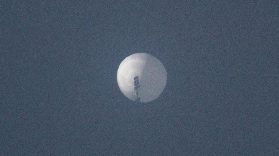
Surveillance balloons follow the prevailing winds
The Chinese authorities say a surveillance balloon sighted over sensitive US territory is theirs, but insist its purpose is for weather research and that it was blown off course by unexpected winds.
We've looked at the prevailing wind patterns and data modelling to track its possible path.
Where has the balloon been seen?
It was monitored travelling across Canadian territory before appearing over the city of Billings in Montana on Wednesday, where it was spotted in the sky by city residents.
US authorities say they've been tracking the balloon across US airspace using manned aircraft, and that it's been flying over sensitive military areas.
Blown off course, says China
China says strong "westerlies" blew the device "with limited self-steering capability" off its planned course.
BBC Weather's Simon King says that in the north Pacific between China and North America, the prevailing winds are westerlies (that is, from west towards the east).
"In recent days, the wind speeds above an altitude of 30,000 to 40,000ft (9,000 to 12,000m) were 150mph (240km/h) or above in this area of the Pacific," he says. "There is nothing unusual about wind speeds this high in this area."
The wind patterns in the north Pacific in the past few days would have blown the balloon north-west to Alaska and then south-west through Canada to Montana, he says.
"Most weather balloons rise to about 100,000ft and then blow apart after a few hours, with the equipment falling to Earth by parachute. It is unusual for a weather balloon to last days like this."
Dr Marina Miron, researcher in defence studies at Kings College London says the balloon might have been more sophisticated than China claims.
"The balloon could be controlled remotely by an operator on the ground," she says. "They'd be able to raise or lower the altitude of the balloon so that it could pick up different wind currents which are going in different directions.
"You would want to be able to make it linger over a spot to collect data. This is something you can do with balloon which you cannot do with a satellite."
Can we track its route?
Not with any certainty. We don't have flight tracking data that we would for commercial airliner, for example, so we need to look to other sources of information.
One technique used to estimate the path of high-altitude, particles or objects is to use a model based on wind speeds and direction.
The National Oceanic and Atmospheric US department (NOAA) has developed such a model (known as HYSPLIT) based on winds at altitudes over 14,000m (46,000ft).
"Its primary use," says Simon King from BBC Weather, "is for working out the transport and dispersion of things such as pollutants and hazardous material in the atmosphere.
"The model also works backwards - called back trajectory - where we can see where anything carried in the air such as pollutants, ash or other material has come from.
"In the case of the balloon over the US, this back trajectory can shows where the air carrying the balloon originated from and by analysing wind direction and speed, where it'll go in the future."
US meteorologist Dan Satterfield has used this model to calculate a possible route the surveillance balloon has taken, and has shared his findings online.
Starting from the position sighted in Montana on 1 February, he has estimated a possible back trajectory for the balloon, based on wind data, originating in central China.
It must be stressed that this is not the actual path the surveillance balloon has taken, but an analysis based on the model developed by NOAA, a US government agency.

 3 years ago
51


 English (US) ·