ARTICLE AD BOX
 Image source, NOAA
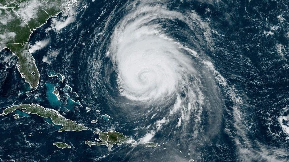
A massive hurricane churning in the Atlantic Ocean is set to impact the east coast of the US and Canada this weekend, according to forecasters.
Hurricane Lee turned north on Wednesday and is forecast to grow larger as it travels, becoming a huge hurricane off the New England shore by Friday night.
Lee currently has sustained winds of 110 mph (175 km/h), according to the US National Hurricane Center (NHC).
Residents in coastal Canada have also been warned to brace for the storm.
"Slow weakening is forecast during the next few days, however, Lee is likely to remain a large and dangerous hurricane into the weekend," the NHC said in an advisory on Wednesday.
Forecasters say that, due to Lee's large size, areas far from the hurricane's centre could feel its effects.
Lee dropped to a category two hurricane on Wednesday. Hurricane force winds can be felt 115 miles (185km) from it's centre, while tropical storm force winds extend outward up to 240 miles.
Already, Lee is "producing dangerous surf and rip currents" on the southeastern US coast, said the US National Weather Service (NWS).
Bermuda has been placed under a tropical storm warning.
Lee, which formed in the first week of September, is expected to lash states that have already seen above average rainfall over the past month.
Massachusetts Governor Maura Healey declared a state of emergency on Tuesday night after flash floods washed out roads, created sinkholes and destroyed buildings in parts of the state.
Experts also warn that the hurricane may topple trees.
Watch: Stunning lightning strikes at the heart of Hurricane Lee
Due to Lee's size, experts say it's too early to tell where it may make landfall. But they said it will likely be somewhere between Maine and Nova Scotia on Sunday or Monday.
Ahead of landfall, forecasters say Lee will bring coastal flooding, several inches of rain and storm surges to the region by the weekend.
Forecasters should be able to chart its projected course more accurately in the coming days.
Lee is the 12th named storm of the Atlantic hurricane season, which runs from June to November and is expected this year to be more active than average.
Lee grew from a category one to a category five in 24 hours on 8 September - the third fastest intensification in the past 40 years, which stunned climate scientists.
The impact of climate change on the frequency of tropical storms is still unclear, but increased sea surface temperatures warm the air above and make more energy available to drive hurricanes.
As a result, they are likely to be more intense with more extreme rainfall.
Additional reporting by Max Matza

 2 years ago
127


 English (US) ·