ARTICLE AD BOX

By Brandon Drenon
BBC News, Washington
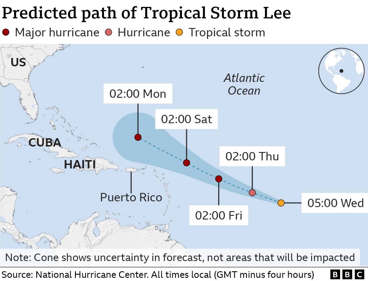
Hurricane Lee has powered up to a category four storm, packing wind speeds of up to 130mph (215km/h) as it churns through the Caribbean.
Forecasters say Lee could become the first category five hurricane of the Atlantic season by Friday.
On its current path the storm is not projected to make landfall anywhere.
Lee is the 12th named storm of the Atlantic hurricane season, which runs from June to November.
It rapidly intensified from a category one within the span of hours.
"Additional strengthening is expected tonight," said the US National Hurricane Center (NHC) at 17:00 EDT (21:00 GMT) on Thursday.
Dangerous surf and rip currents are expected to reach the northern Caribbean by Friday and parts of Puerto Rico and the US east coast by Sunday, said the US National Hurricane Center (NHC).
On Thursday evening, Lee was about 780 miles east of the northern Leeward Islands, where the Caribbean meets the Atlantic Ocean.
US President Joe Biden has been updated on its trajectory.
Meanwhile, Tropical Depression 14 has become Tropical Storm Margot.
Margot is projected to gain hurricane strength over the weekend, though it is expected to stay over open water.
Out in the Pacific Ocean, Hurricane Jova has weakened slightly from a category five to four storm.
It was barrelling far from south-western Mexico, and it is not expected to make landfall either.
The 2023 Atlantic hurricane season is forecast to be more active than average.
The impact of climate change on the frequency of tropical storms is still unclear, but increased sea surface temperatures warm the air above and make more energy available to drive hurricanes.
As a result, they are likely to be more intense with more extreme rainfall.

 2 years ago
43


 English (US) ·