ARTICLE AD BOX
 Image source, Maxar Technologies
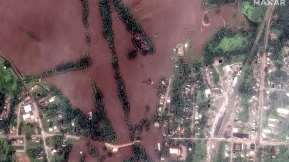
The heavy storms flooded the Winooski river in Richmond, Vermont
Newly released Maxar satellite images show the devastating flooding that days of storms have brought to the north-eastern US.
Officials in Vermont and New York have just begun clean-up efforts after historic rainfall caused dangerous flash flooding that killed one person.
More than 100 people in Vermont had to be rescued.
The deluge battered businesses, homes, roads and bridges across the two states.
Image source, Maxar Technologies
Image caption,Satellite image show athletic fields near the Hudson River in West Point, New York in September 2022
Image source, Maxar Technologies
Image caption,A satellite image shows flooded athletic fields along the Hudson River after days of storms
New York state saw some of the worst flooding in years, including in Orange County in the Hudson Valley, where a 43-year-old woman died trying to flee her home with her dog.
The rains flooded rivers in both states and prompted concerns about several Vermont dams reaching capacity.
Image source, Maxar Technologies
Image caption,This image shows the Winooski River in Vermont in June 2019
Image source, Maxar Technologies
Image caption,The Winooski river in Vermont was flooded after intense rain
President Joe Biden declared a state of emergency for Vermont on Tuesday, when some streets were completely under water after the Winooski River burst its banks.
The order was lifted as the rain ceased, but Vermont Governor Phil Scott has warned of more precipitation later this week, which he said "will have nowhere to go in the over-saturated ground".
Many factors contribute to flooding, but a warming atmosphere caused by climate change makes extreme rainfall more likely.
The world has already warmed by about 1.1C since the industrial era began and temperatures will keep rising unless governments around the world make steep cuts to emissions.
All photos subject to copyright.

 1 year ago
45


 English (US)